A new study through the U.S. Geological Survey (USGS) hopes to understand Yellowstone National Park’s underground plumbing.
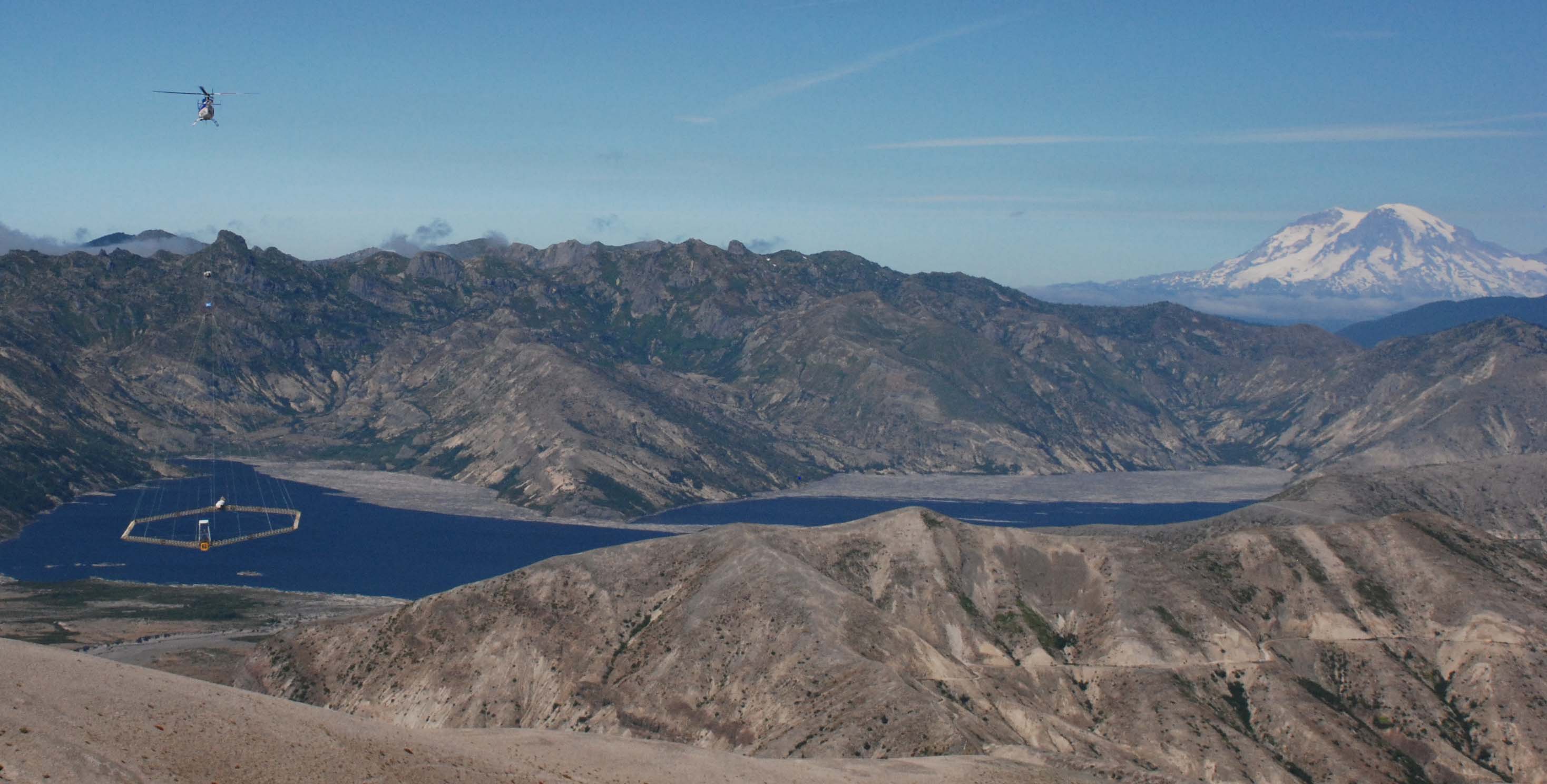
According to the USGS, starting November 7, the same day most of Yellowstone’s roads close for the season, crews will start flying helicopter electromagnetic and magnetic (HEM) surveys to chart what lies beneath Yellowstone’s surface. Below is an example of the equipment that will be used, as seen on a HEM survey of Spirit Lake in Washington state, courtesy of the USGS:
The scientists in the study (from the USGS, University of Wyoming, and Denmark’s Aarhus University) hope the survey will shed light not only on the movement of groundwater around the Park but also what type of water (cold fresh water, hot saline water, steam) moves through what kind of material (clay, unaltered) in Yellowstone National Park’s hydrothermal systems. From the USGS press release:
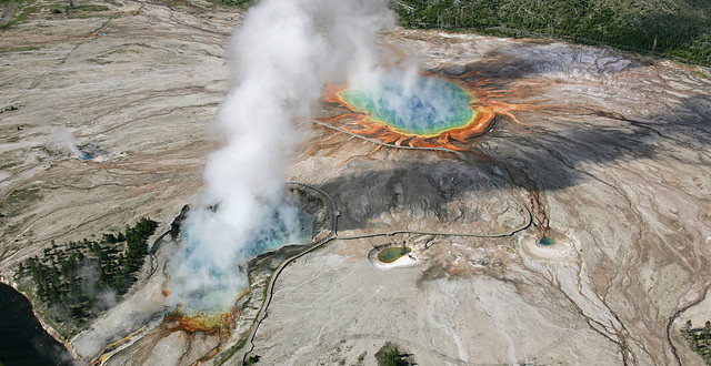
Although the park’s iconic hydrothermal systems are well mapped at the surface, their subsurface groundwater flow systems are almost completely unknown. The HEM survey, operated by SkyTEM, will provide the first subsurface view of Yellowstone’s hydrothermal systems, tracking the geophysical signatures of geysers, hot springs, mud pots, steam vents and hydrothermal explosion craters to depths in excess of 1,000 feet.
A low flying helicopter, about 200 feet above the ground’s surface, will travel along pre-planned flight grids focusing on the Mammoth-Norris corridor, Upper and Lower Geyser Basins and the northern part of Yellowstone Lake. An electromagnetic system, resembling a giant hula hoop, will be suspended from the helicopter’s base. The equipment senses and records tiny voltages that can be related to the ground’s electrical conductivity.
These observations, combined with existing geophysical, geochemical, geological and borehole data, will help close a major knowledge gap between the surface hydrothermal systems and the deeper magmatic system. For example, research shows that the hot water spurting from Yellowstone’s geysers originates as old precipitation, snow and rain that percolates down into the crust, is heated and ultimately returns to the surface. This process takes hundreds if not thousands of years. Little, however, is currently known about the paths taken by the waters.
If successful, data from the study will be used to help structure future “ground-based geological, hydrological and geophysical studies.”
HEM flights will take place over the next two to four weeks.

You must be logged in to post a comment.