The first column contains the names of notable places, mostly in relation to a geographical area, or a particular section of road. The other three columns — Major Highlights, Good to See, Time Allowing — classify the feature or location as how important it is to see something depending on how much time is available.
For each item the diamonds mark the appropriate column and rank the importance (from 1 diamond, low to 4 diamonds, high) within that column. The diamonds are color-coded by column: Red = Major Highlight, Blue = Good to See, Black = If Time Allows. (The Yellowstone Insider book is keyed the same way.) For example, Old Faithful is in the Major Highlight column and has 4 red stars, which makes it a Must See. Another example: Lonestar Geyser Trail is in the If Time Allows column, but has four black diamonds, which makes it a top attraction…if time allows.
The length of this table is a good indication of how richly the Greater Yellowstone Region is blessed with natural features and interesting places. The word is: incomparable.
In general, the shorter the visit, the more appropriate it may be to visit places highly rated as Major Highlight or Good to See. Features with a four-diamond rating are most appropriate for one or two day visitors, especially those who are in the area for the first time. People who have been to the Yellowstone region fairly often may find some little-known but very interesting things to visit in the Good to See and If Time Allows columns.
GOING TO OR FROM THE GRAND LOOP ROAD
| LOCATION / FEATURE | Major Highlight | Good to See | If Time Allows |
| WEST and NORTHWEST | |||
| Bozeman, Montana | |||
| Museum of the Rockies |
♦♦♦ |
||
| U.S. Highway 191 |
♦♦ |
||
| Big Sky, Montana |
♦♦ |
||
| Hebgen Lake |
♦ |
||
| Quake Lake (on U.S. 289) |
♦ |
||
| West Yellowstone, Montana | |||
| The Museum of Yellowstone |
♦♦ |
||
| Grizzly Discovery Center |
♦ |
||
| Yellowstone IMAX Theater |
♦♦♦ |
||
| WEST ENTRANCE | |||
| West Entrance Road |
♦♦♦♦ |
||
| Riverside Road |
♦ |
||
| SOUTH | |||
| J.D. Rockefeller Memorial Drive (Highway) | |||
| Grand Teton National Park |
♦♦♦♦ |
||
| Teton Park Road |
♦♦♦♦ |
||
| Signal Mountain Road |
♦ |
||
| Jenny Lake/String Lake |
♦♦♦ |
||
| Jackson Lake Lodge |
♦ |
||
| Colter Bay Village | |||
| Lakeshore Trail |
♦♦♦ |
||
| Jackson, Wyoming | |||
| National Museum of Wildlife Art |
♦♦♦♦ |
||
| National Elk Refuge (winter/summer) |
♦♦♦w |
♦s |
|
| Jackson Hole Museum |
♦♦ |
||
| SOUTH ENTRANCE | |||
| South Entrance Road |
♦ |
||
| Moose Falls |
♦ |
||
| Lewis Falls and Lake |
♦♦ |
||
| Grant Village |
♦ |
||
| Grant Village Visitor Center |
♦♦♦ |
||
| Yellowstone Lake Overlook Trail |
♦♦♦ |
||
| EAST | |||
| Cody, Wyoming | |||
| Buffalo Bill Historical Center |
♦♦♦♦ |
||
| Cody Nite Rodeo |
♦♦ |
||
| Cody Stampede (July) |
♦♦♦♦ |
||
| The Irma Hotel |
♦ |
||
|
Cody Memorial Highway
|
♦♦♦ |
||
| Buffalo Bill Dam and Reservoir |
♦♦♦ |
||
| The Sacred City |
♦♦♦ |
||
| The Hoodoos |
♦♦ |
||
| Pahaska Teepee |
♦♦ |
||
| EAST ENTRANCE | |||
| East Entrance Road |
♦♦ |
||
| Sylvan Lake |
♦♦ |
||
| Steamboat Point and Thermal Area |
♦♦ |
||
| Storm Point Nature Trail |
♦♦♦♦ |
||
| NORTHEAST | |||
| Red Lodge, Montana | |||
| Pollard Hotel |
♦ |
||
|
Beartooth Highway
|
♦♦♦♦ |
||
| Rock Creek Overlook |
♦♦♦ |
||
| Twin Lakes Overlook |
♦♦♦ |
||
| Beartooth Pass |
♦♦ |
||
| Beartooth Lake |
♦ |
||
| Clark’s Fork Overlook |
♦♦♦ |
||
| Crazy Creek (May-July) |
♦♦ |
||
|
Chief Joseph Highway
|
♦♦♦♦ |
||
| Red Hills Overlook |
♦ |
||
| Dead Indian Pass |
♦♦♦ |
||
| Garrison Creek Bridge |
♦ |
||
| Cooke City, Silver Gate, Colter Pass, Montana | |||
| NORTHEAST ENTRANCE | |||
|
Northeast Entrance Road |
♦♦♦ |
||
| Soda Butte |
♦ |
||
| Lamar Valley |
♦♦ |
||
| Slough Creek |
♦♦ |
||
| Yellowstone River Overlook |
♦♦♦ |
||
| NORTH | |||
| Livingston, Montana | |||
|
Paradise Valley (U.S. Highway 289)
|
♦♦♦ |
||
| Chico Hot Springs Hotel |
♦♦ |
||
| Devil’s Slide |
♦ |
||
| Gardiner, Montana | |||
| NORTH ENTRANCE | |||
| North Entrance Road |
♦ |
||
| North Entrance Arch |
♦ |
||
| Gardner Canyon (Sheep Cliffs) |
♦♦ |
ON THE GRAND LOOP ROAD
| LOCATION / FEATURE | Major Highlight | Good to See | If Time Allows |
| Madison Junction to Old Faithful |
♦♦♦ |
||
| Firehole Canyon Drive |
♦ |
||
| Fountain Flats Drive |
♦♦ |
||
| Lower Geyser Basin |
♦♦♦ |
||
| Firehole Lake Drive / Fountain Geyser |
♦♦♦♦ |
||
| Fountain Paint Pot Loop Walk |
♦♦♦ |
||
| Midway Geyser Basin |
♦♦ |
||
| Loop Walk |
♦♦♦ |
||
| Grand Prismatic Spring |
♦♦ |
||
| Biscuit Basin |
♦♦♦♦ |
||
| Biscuit Basin Walk |
♦♦♦♦ |
||
| Black Sand Geyser Basin |
♦♦♦ |
||
| Black Sand Basin Walk |
♦♦♦ |
||
| Old Faithful – Upper Geyser Basin |
♦♦♦♦ |
||
| Old Faithful Geyser |
♦♦♦♦ |
||
| Geyser Hill |
♦♦ |
||
| Firehole River Walk |
♦♦♦♦ |
||
| Black Sand Trail |
♦♦♦♦ |
||
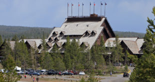
| Old Faithful Inn |
♦♦ |
||
| Old Faithful to West Thumb |
♦ |
||
| Kepler Cascade |
♦ |
||
| Lonestar Geyser Trail |
♦♦♦♦ |
||
| Shoshone Lake Viewpoint |
♦ |
||
| Continental Divide |
♦♦ |
||
| West Thumb Geyser Basin |
♦♦ |
||
| Geyser Basin Walk |
♦♦♦ |
||
| West Thumb to Fishing Bridge |
♦ |
||
| Gull Point Drive |
♦♦ |
||
| Bridge Bay |
♦♦ |
||
| Lake Village |
♦♦♦♦ |
||
| Lake Hotel |
♦♦♦ |
||
| Fishing Bridge Area |
♦♦♦ |
||
| The Fishing Bridge |
♦♦ |
||
| Fishing Bridge Museum/Visitor Center |
♦♦ |
||
| Fishing Bridge to Canyon |
♦♦♦ |
||
| Le Hardy Rapids Walk |
♦♦♦♦ |
||
| Mud Volcano Area |
♦ |
||
| Mud Volcano Walk |
♦♦♦♦ |
||
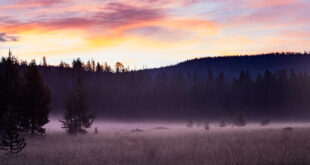
| Hayden Valley |
♦♦ |
||
| Wildlife Overlook |
♦♦ |
||
| Canyon Area |
♦♦♦♦ |
||
| South Rim Drive |
♦♦♦♦ |
||
| Uncle Tom’s Overlook |
♦♦ |
||
| Artist Point |
♦♦♦♦ |
||
| Brink of Upper Falls Road |
♦♦ |
||
| Brink of Upper Falls Trail |
♦♦♦♦ |
||
| North Rim Drive |
♦♦♦ |
||
| Inspiration Point |
♦♦♦ |
||
| Brink of Lower Falls Trail |
♦♦♦ |
||
| Canyon Village |
♦ |
||
| Canyon Visitor Center |
♦ |
||
| Canyon to Tower-Roosevelt Junction |
♦♦ |
||
| Washburn Hot Springs Overlook |
♦♦♦ |
||
| Dunraven Pass/Mt.Washburn Trail |
♦♦♦♦ |
||
| Chittenden Road |
♦♦♦ |
||
| Tower Fall |
♦ |
||
| Calcite Springs Overlook |
♦ |
||
| Roosevelt Lodge |
♦♦♦ |
||
| Tower-Roosevelt Junction to Mammoth |
♦ |
||
| Petrified Tree |
♦♦ |
||
| Hell Roaring Canyon Overlook |
♦ |
||
| Blacktail Plateau Drive |
♦♦♦ |
||
| Wraith Falls Trail |
♦♦ |
||
| Mammoth Hot Springs Area |
♦♦ |
||
| Lower Terrace |
♦♦♦♦ |
||
| Albright Museum |
♦♦ |
||
| Mammoth Hotel |
♦ |
||
| Upper Terrace Drive (Mammoth) |
♦♦ |
||
| Mammoth to Norris |
♦♦ |
||
| Golden Gate |
♦♦♦ |
||
| Sheepeater Cliff |
♦♦♦ |
||
| Obsidian Cliff |
♦♦♦ |
||
| Roaring Mountain |
♦ |
||
| Norris Geyser Basin |
♦♦♦ |
||
| Porcelain Basin Walk |
♦♦ |
||
| Back Basin Walk |
♦ |
||
| Norris Geyser Basin Museum |
♦♦ |
||
| Museum of the National Park Ranger |
♦♦ |
||
| Norris to Canyon |
♦ |
||
| Virginia Falls Drive |
♦♦♦ |
||
| Norris to Madison Junction |
♦♦ |
||
| Artist’s Paintpots |
♦ |
||
| Beryl Spring |
♦♦ |
||
| Gibbon Falls |
♦♦ |
||
| Terrace Spring Thermal Area |
♦♦♦ |
||
| Bechler Region (Southwest) |
♦♦♦ |
||
| Cave Falls |
♦♦♦ |