Yellowstone National Park just got a nifty way to assess what roads need resurfacing in the Park, courtesy of the Sanborn Map Company, Inc.
Read More »Sanborn Maps Yellowstone National Park Roadways
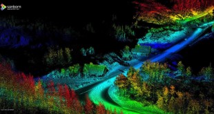
Yellowstone National Park just got a nifty way to assess what roads need resurfacing in the Park, courtesy of the Sanborn Map Company, Inc.
Read More »