Fire growth in Yellowstone National Park was milder than expected yesterday as crews prepare for more critical fire weather this week.
The news comes as Yellowstone officials decree Stage 2 Fire Restrictions for the entire Park. We previously reported the National Weather Service had issued a Red Flag Warning for Yellowstone for Wednesday, Thursday, and Friday, warning that high winds, hot temperatures, and dry thunderstorm conditions could spur fire growth, with Maple Fire as a special concern.
West Yellowstone residents/visitors should expect “unhealthy” smoke conditions throughout the day, although smoke is expected to ameliorate by mid-afternoon.
According to a Yellowstone press release, Maple Fire has grown to 38,004 acres (an approximately 1,285 acre increase). The fire is now 3.56 miles northeast of West Yellowstone/the intersection of U.S. 20 & 287, 3.57 miles southwest of the Mount Holmes Fire Lookout, and 1.78 miles from Madison Junction.
A community meeting about the Maple Fire will be held tonight at 7:30 p.m. at the LDS Church in West Yellowstone on 245 Faithful Street.
Fire managers are monitoring the fire, deploying night shifts to assess activity around Seven Mile Bridge and the Duck Creek subdivision. Contingency plans are in place in case the fire starts spreading toward U.S. 191.
Crews are currently working east of the Seven Mile Bridge along the Madison River, removing weakened trees and proceeding with burnout operations on the road. Traffic has been reduced to one lane on the West Entrance Road.
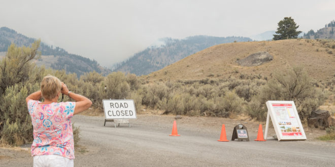
Visitors may safely view the Maple Fire at designated areas along the route; fire information personnel are on hand to answer questions.
To the west, crews are nearly done with a fuel reduction project east of Boundary Street and north of the West Entrance. Crews also completed a handline from Gneiss Creek to a ridgetop east of Campanula Creek. Two helicopters (a type 1 Chinook and smaller type 2 craft) and two Fire Boss water scoopers are providing water drops as needed.
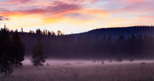
To the east, Buffalo Fire has grown to 4,524 acres, an approximately 82-acre increase. Currently, it is three miles northeast of Tower Junction and two miles south of the Park boundary. Ground crews warn the fire could spread over the next several days and are currently fighting hot spots in the Slough Creek Campground area. Smoke from the Buffalo Fire is now visible from the Lamar Valley, as you can see in the picture at the top.
Portions of the Slough Creek road are closed at this time.
Fawn Fire, meanwhile, has grown to 2,129 acres, or an addition al 56 acres. It is now eight miles west of Mammoth Hot Springs. Crews continue to monitor Fawn Fire from the Fawn Pass cabin.
Finally, Central Fire has grown to 1,193 acres, up 150 acres. It is now 8.5 miles from Lake Village and two miles south of the Hayden Valley. It continues to burn through a 1988 fire scar. Growth to the southeast was curbed by ground conditions left by the 2015 Spruce Fire. Smoke from the Central Fire should be visible from the Hayden Valley, Fishing Bridge, and Mammoth Hot Springs.
Below is the full list of campsite and trail closures in effect due to fire activity, including portions of nearby Custer Gallatin National Forest:
• From the intersection of Highway 191 and Duck Creek Road #2523 (south side of the road), to Yellowstone National Park boundary, including the fishing access road at the end of Duck Creek road, south along YNP line to the north side of the Madison River bluff, then north along east side of Highway 191 back to the starting point, excluding the transfer station and road #6794
Campsites
• Slough Creek Campground
• WA1
• 1C1
• 1C2
• 1C4
• 1C5
• WB1
• WB3
• WB4
• WB6
• 2S1
• 2S2
• 2S3
• 2S4
• 2S6
• 2S7
• 2S8
Trails
• Mary Mountain Trail (including Mary Lake Patrol Cabin).
• Old Airport Road in West Yellowstone.
• Purple Mountain Trail.
• Riverside Trail.
• Cougar Creek Trail.
• Harlequin Lake Trail.
• Mount Holmes Trail.
• Winter Creek Trail.
• Grizzly Lake Trail.
• Trilobite Lake Trail.
• Slough Creek trail and “associated Day Use area.”
• Bliss Pass Trail between Slough Creek and Pebble Creek trail.
• Buffalo Fork Trail from the trailhead at Slough Creek to the Park Boundary.
• Gneiss Creek Trail from the Gneiss Creek Trailhead (WK7) to Seven Mile Bridge Trailhead (WK8).
• Bighorn Pass trail eastbound at the junction of the cut-off trail to the Fawn Pass trail.
• Bighorn Pass trail westbound at Bighorn Pass.
• Fawn Pass trail eastbound at the junction of the cut-off trail to the Big Horn Pass trail.
• Fawn Pass trail westbound at campsite 1F2.
All park roads (except portions of the Slough Creek Road) and visitor facilities, both NPS- and concessionaire-operated, are open at this time.