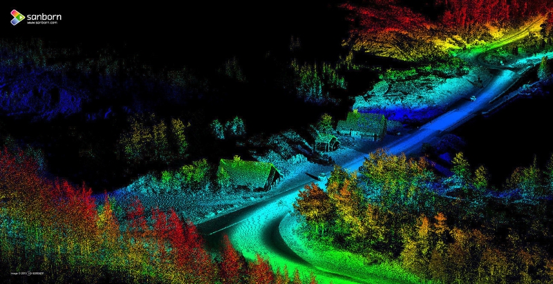
The Sanborn Map Company, Inc. collected this high-resolution mobile light detection and ranging (LiDAR) image of a corridor in Glacier National Park. Sanborn collected more than 40 miles of LiDAR imagery in Glacier and Yellowstone national parks for the analysis, planning and engineering of critically needed road resurfacing.